ServiceNew York City
Demolition-adjacent documentation
Before the teardownTime-stamped
Pre-demolition surveys, New York

Pre-demolition survey
in New York City.

Before a teardown starts, the buildings around it need a dated record of how they looked. That record is a pre-demolition survey: high-resolution photographs of every adjoining structure, captured while the building is still standing and archived for as long as the claim window stays open.

Section 01What the record is

The buildings beside a teardown need a dated record of their own.

Adjoining structures.
Photographed first.

Demolition is the loudest thing that happens on a block. Machines break masonry, floors drop, trucks idle at the curb for weeks, and every building sharing a wall or a lot line with the site feels all of it.

A pre-demolition survey is the photographic baseline taken before any of that begins. We walk the adjoining properties with the owner's permission and shoot the exterior elevations, the party walls, the roof surfaces, and every accessible interior room, calling out the cracks, the settlement, the patched plaster, and the prior repairs already there. Each frame carries its capture time and location in the file. Months later, when someone points at a crack and says the demolition put it there, the answer is a photograph with a date on it.

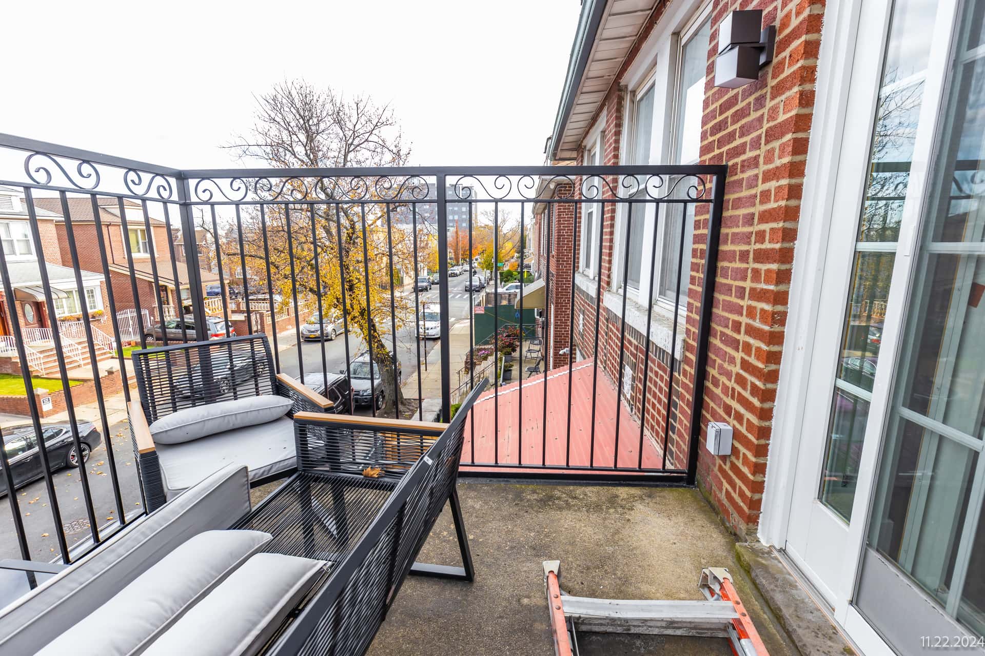
Balcony railing and red brick facade of a New York City home adjoining a demolition site, recorded by OpenDoors360 as part of a pre-demolition survey baseline.
Adjoining property, exterior baseline · New York City

A baseline is easy to capture and impossible to recreate. Once the machines arrive, the before is gone.

Section 02Why demolition raises the stakes

A teardown loads the neighbors differently than a dig does.

Vibration. Debris.
Exposed party walls.

Excavation moves soil under a building. Demolition removes a building that other buildings have been leaning on, sometimes for a century. The risk radiates outward from the lot line in three bands, and the survey scope follows them.

  1. Zone 01 · At the lot line

    The party wall you're about to expose.

    On a rowhouse block the wall between two buildings is often one wall, shared. Take one side down and the other side meets weather, temperature swings, and its own unsupported edge for the first time in its life. The survey documents that wall from both faces while both faces still exist: the flashing, the pointing, the old flues, and the plaster on the neighbor's side of it.

  2. Zone 02 · Vibration and debris radius

    Everything the machines can reach.

    Mechanical demolition sends vibration through the ground and into neighboring slabs, and it throws dust and fragments further than most owners expect. Buildings across a shared alley, storefronts under a sidewalk shed, and the stoops and areaways at street level all sit inside that radius. Each one gets photographed before the first bucket swings.

  3. Zone 03 · Within 90 feet of a landmark

    The landmark radius.

    TPPN 10/88, a DOB technical policy, extends documentation and monitoring to designated landmark buildings within 90 feet of certain excavation and foundation work. In Brooklyn Heights, Park Slope, or much of lower Manhattan, that circle catches something more often than it misses, and finding it late in preconstruction planning is an expensive surprise.

Section 03What gets documented next door

Elevation by elevation on the building we're there to protect.

Four passes.
One adjoining property.

Every adjoining property in scope gets the same four passes in the same order, so the record reads the same way whether an adjuster opens it next month or an attorney opens it in three years.

Elevation 01

Street face, stoop, and sidewalk.

We start where the public can see, because that's where a claim usually starts too. Brickwork, lintels, cornice, window frames, the stoop, the areaway, and the sidewalk flags in front of it. Spalled mortar at the base of a wall and a hairline in a concrete step are exactly the conditions someone will point at later, so each one gets a close-up with a location note beside the wider context frame.
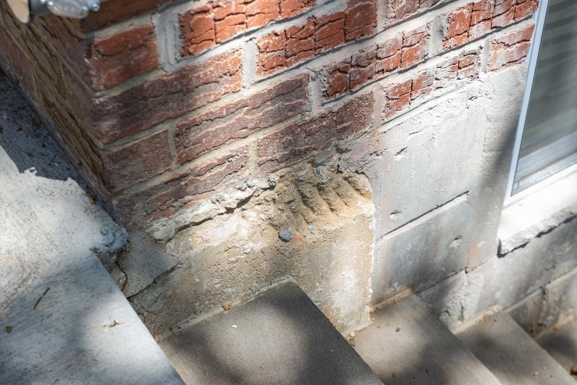
Spalled mortar and cracked parging where a brick wall meets a concrete stoop on a building adjoining a New York City demolition site, photographed by OpenDoors360 for a pre-demolition survey.
Elevation 02

Party wall and lot line.

The shared boundary is the highest-risk surface on the job, so it gets the longest pass. Where two buildings meet we record the parapet, the flashing at the roof line, exposed sheathing, the coping, and the mortar joints along the full height of the wall. Where an alley separates the buildings instead, the alley pavement and the lower wall come with it.

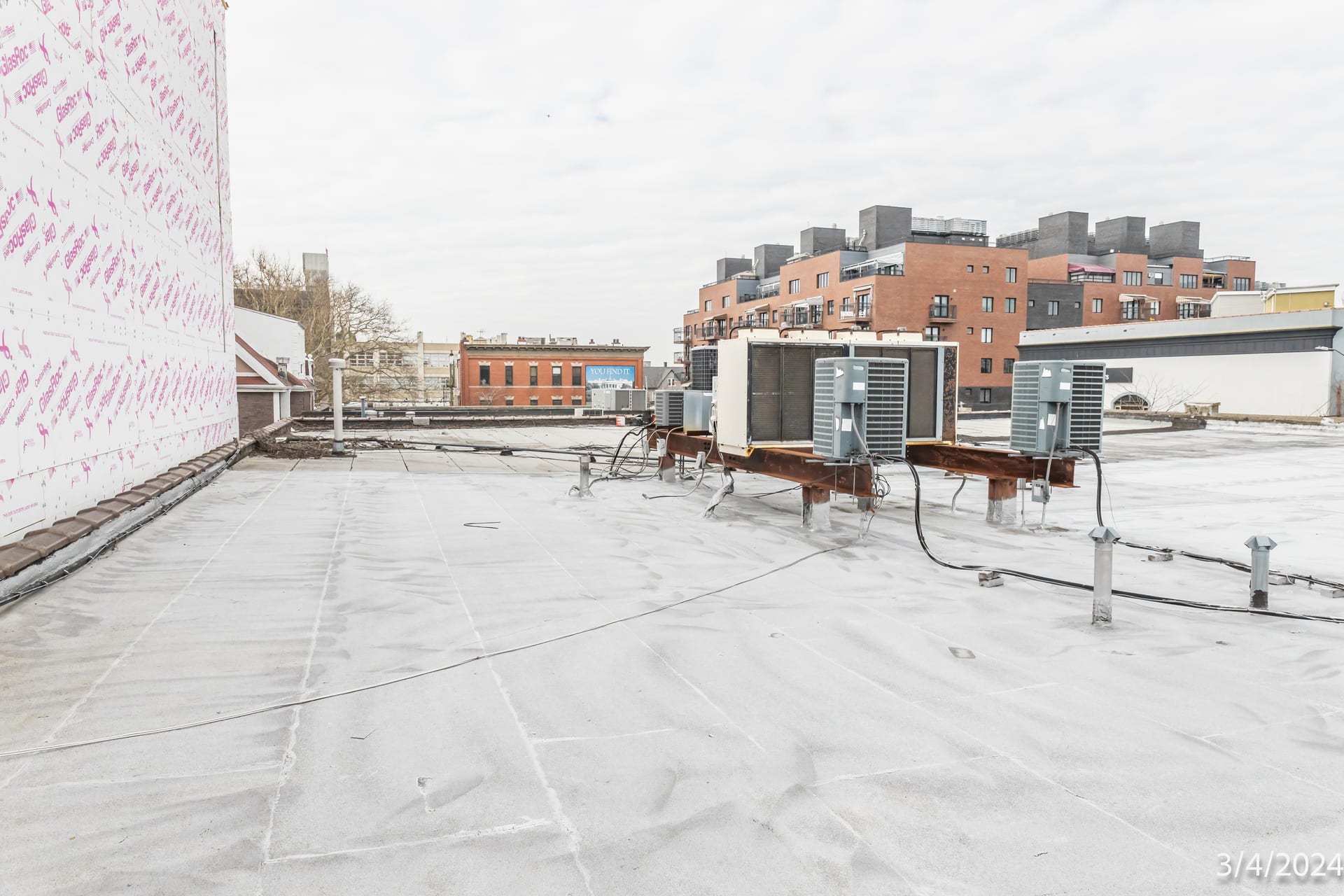
Party wall sheathing, parapet, and flat roof membrane on a New York City building adjoining a demolition site, documented by OpenDoors360 in a pre-demolition survey.
Elevation 03

Roof, parapet, and rooftop equipment.

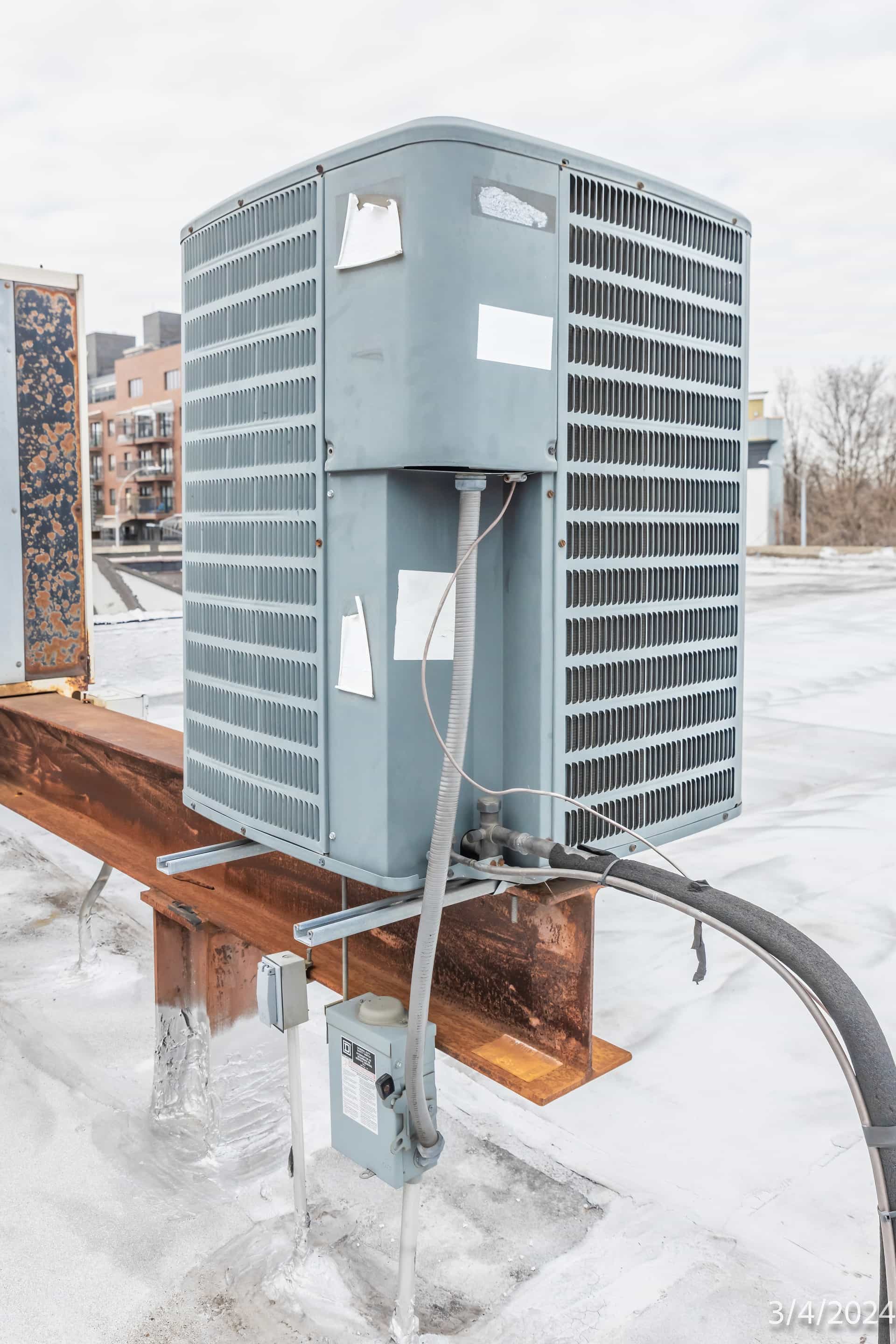
Roofs carry the equipment an owner notices fastest and the surfaces that leak first. Condensers, their steel supports, conduit runs, disconnects, vents, drains, and the membrane around all of it get photographed in place. If a unit shifts on its beam or a seam opens while the teardown is running, the before frame is already sitting in the file.

Rooftop condenser unit on a rusted steel support beam with electrical disconnects, recorded on a New York City building next to a demolition site during an OpenDoors360 pre-demolition survey.
Elevation 04

Interiors, room by room.

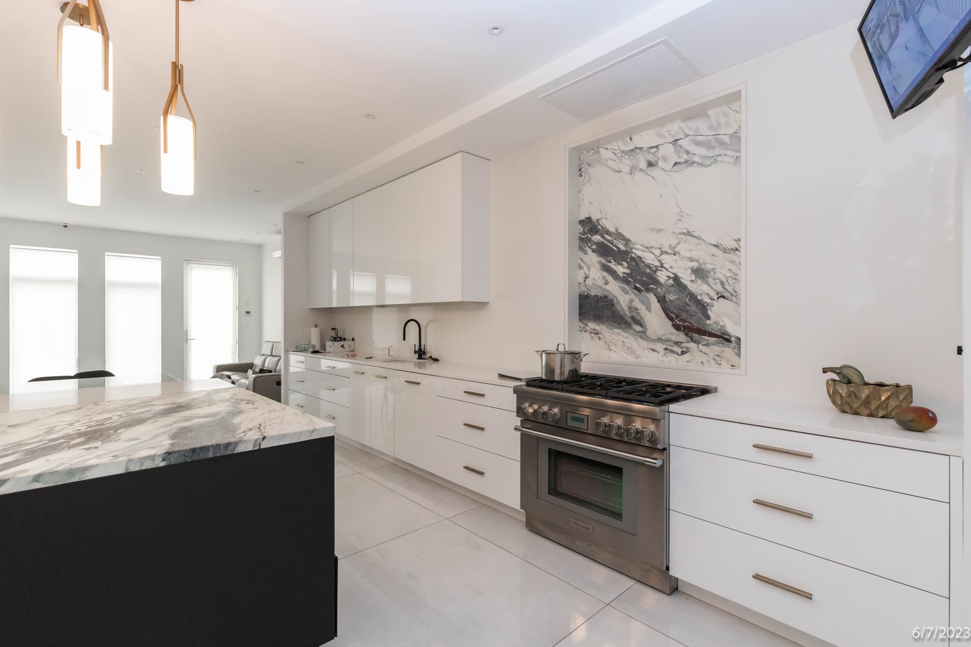
Settlement shows on plaster and trim long before it shows on brick, which makes interiors the half that decides most disputes. With the neighbor's permission we work through every accessible room: walls, ceilings, floors, stair runs, window and door reveals, kitchens, baths, and the mechanical spaces below. Finished rooms get the same coverage as unfinished ones, because that's where a claim gets expensive.

Interior kitchen with marble island and stainless range inside a New York City residence adjoining a demolition site, photographed room by room for an OpenDoors360 pre-demolition survey.
Section 04Who does what

Four parties, one file, and a clear line between them.

Documentation.
Not engineering.

The question we field most on a demolition job is about responsibility: who orders the record, who runs the monitoring, and where a photography firm sits in that chain.

Typical roles on a New York City demolition job
Party Orders the survey Runs the monitoring plan Produces the photographic record Seals and files with the DOB
Owner or developer UsuallyCommissions itReceives itThrough the design team
General contractor Often, by contractCoordinates accessReceives itThrough the filing representative
Engineer of record Sets the scopeDesigns and runs itReviews it in the fileYes
OpenDoors360 NoNoYesNo
Adjoining owner NoNoGrants accessNo

One boundary, stated plainly: we produce the photographic record. We're not a licensed engineering firm, we don't seal or file reports, and nothing we deliver replaces the engineer of record's work. What we hand over is built to sit inside that engineer's file, and general contractors bring us in exactly that way.

The same line applies to the code question. Whether your scope triggers a documentation requirement is a call for your design team and your filing representative, and we won't pretend otherwise. Send us the scope and we'll document the adjoining properties either way, because a record taken before the machines arrive is the part that protects you.

Section 05When the record is called for

Demolition work that puts a documented baseline on the critical path.

Code thresholds.
Insurer requirements.

If you're unsure which of those your job hits, send the scope. The regulatory side is walked through in plain English in our guide to NYC pre construction survey requirements, and the parent service page covers the wider range of pre construction surveys we shoot across the five boroughs.

Skipping the record doesn't make the claim go away; it moves the argument from a photograph to a memory, and memory loses. A neighbor who has lived with a crack for eleven years will remember it appearing the week your excavator showed up, and with no dated frame of that wall there's nothing to set against the story.

Section 06Common questions

Pre-demolition surveys, answered.

Project-specific question?
Send the details.
What is a pre-demolition survey?

A dated photographic record of the buildings next to a demolition site, captured before any of the work starts. It documents the exterior elevations, party walls, roof surfaces, and accessible interiors of each adjoining property, calls out the cracks and settlement already there, and archives every frame with its capture time and location.

When is one required in New York City?

The code threshold most demolition jobs meet sits in the excavation that follows the teardown. NYC Building Code Section 3309.4.3 holds a dig 5 to 10 feet deep within 10 feet of an adjacent building, or over 10 feet deep anywhere on the site, until the existing conditions of adjoining buildings are documented. Section 3309.4.4 adds monitoring while the work runs, and TPPN 10/88 extends documentation to designated landmark buildings within 90 feet of certain excavation and foundation work. Whether a specific scope triggers those rules is a call for your design team and filing representative.

Who orders it?

The party causing the work, which in practice means the owner, the developer, or the general contractor by contract. On projects with a monitoring plan the engineer of record usually sets the coverage, and the owner's insurer often drives the scope, since the carrier is the one who would field a damage claim.

What does the survey cover?

Each adjoining property in scope, inside and out: street elevation, stoop and sidewalk, party wall and lot line, roof, parapet and rooftop equipment, and every accessible interior room where the neighbor grants access. Existing defects get their own close-ups with location notes beside the wider context frames, and each image carries its capture time and location in the file.

How is this different from the survey ordered before new construction?

The deliverable is the same photographic record. What differs is the timing and the risk profile: documentation ahead of new construction is usually driven by excavation and underpinning, while a teardown adds vibration, airborne debris, and a party wall that ends up exposed to weather for the first time in its life.

What happens if the survey is skipped?

The claim still arrives, and the argument moves from a photograph to a memory. A crack a neighbor has lived with for years gets dated to the week your machines showed up, and with no frame of that wall from before the work there's little to set against it. Insurers and counsel both treat a missing baseline as the weak point in a defense.

How long does the record need to be kept?

Longer than the job itself. We archive the report and the full-resolution image set through the project and keep it on file past closeout, because damage claims surface after the fence comes down, sometimes after the property has changed hands.

Does it protect against neighbor damage claims?

It gives you the evidence to answer one. A defect photographed before the demolition started predates the demolition, and the capture data carried in each file is what makes that verifiable. We produce the photographic record; we're not a licensed engineering firm and we don't seal or file reports.

Section 07Through the teardown and after

The baseline is the first visit of several.

Revisits during.
Comparison at closeout.

On a demolition job the exposure doesn't end when the building comes down. Revisits while the work runs catch movement early, when it's still small enough to talk about calmly, and a closeout pass once the site is clear finishes the file.

For longer jobs we come back on a schedule the project team sets and re-shoot the same positions, which is the same discipline behind our construction progress photography. When the teardown gives way to new building, the closeout record is a post construction survey of the same adjoining properties, shot to match the baseline frame for frame. The structure of the deliverable itself is walked page by page in our pre construction survey sample report breakdown.

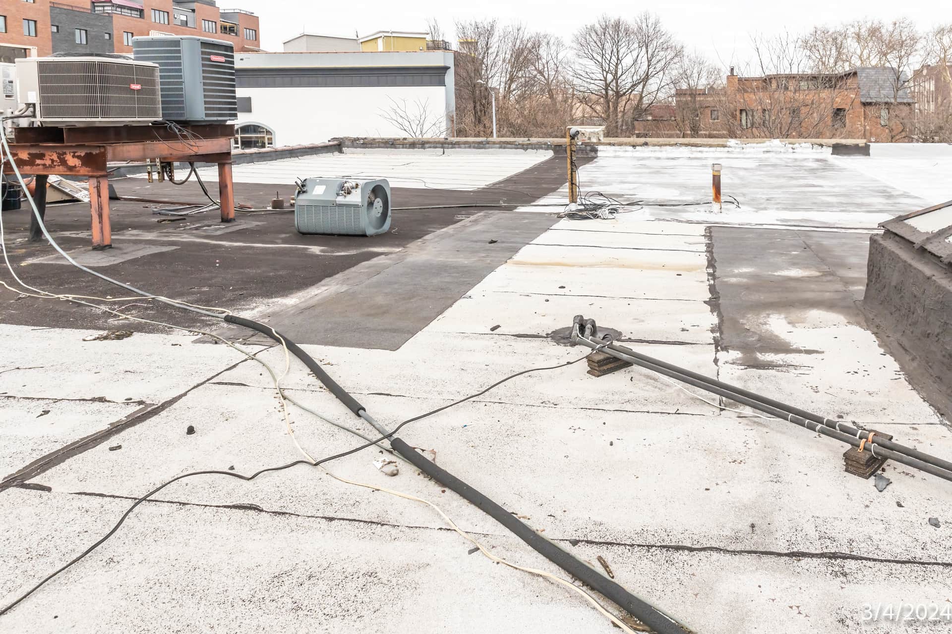
Patched roof membrane, conduit runs, and rooftop condensers re-photographed on a New York City building beside a demolition site during an OpenDoors360 survey revisit.

Send the site address, the demolition scope, and the number of adjoining properties, and we'll come back with a quote. If interior access to a neighbor's building is the open question, say so early, because coordinating those visits is usually what sets the schedule.

Request a quote

Send the project.
We'll send a quote.

Site address, demolition scope, and how many adjoining properties sit in the affected zone. We return a quote, usually within two business hours.

(701) 566-9171 Call or text

Related: pre construction surveys · post construction survey · contact a real estate photographer

Pre-demolition survey inquiry